Best Spots for Winter Hiking in Vancouver for Families
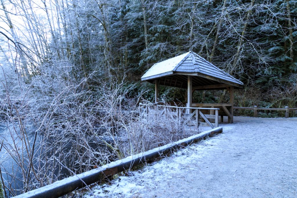
With the unusually cold and wet weather in recent weeks, it may be tempting to decide to simply cozy up at home (with warm blankets, some hot chocolate, and an endless Netflix binge) until spring returns. And while there are plenty of local activities that may be off the menu right now (tennis might be a little tough these days), there are others that can be enjoyed all through the year – if you have the right gear. So get out the hiking shoes, pull on the rain coats, rustle up some warm toques and then check out some of these local family-friendly spots for winter hiking in Vancouver and the surrounding areas.
Where to Go Winter Hiking in Vancouver with Kids
Rolley Lake Provincial Park
A popular camping and beach site through the warmer months, Rolley Lake in Mission is a quiet spot this time of year for a beautiful winter trail walk. There are two trails in the park: the Lakeside Loop is about 40 minutes return, while Rolley Falls – at the far end of the campground area – is about 10 minutes (but more windy and with a few hilly bits.) Check the website for details, maps, closures and other important information.
Rice Lake Loop
Rice Lake Loop is a short two-kilometre trail through the woods around Rice Lake. It’s the easiest and most accessible of a variety of hiking trails – 65 kilometres worth in total – that are part of the Lower Seymour Conservation Area in North Vancouver. Check out the trail maps before going beyond Rice Lake Loop, as some areas are for more advanced hikers. Check the website for details, maps, closures and other important information.
Lynn Canyon Park
Not far from Rice Lake in the Lower Seymour Conservation Area is the neighbouring Lynn Canyon Park, which features a variety of trails – including the Baden Powell trail and the Twin Falls trail – along with a suspension bridge and ecology centre. It’s a wonderful spot for winter hiking in Vancouver. Check the website before heading out as weather can lead to temporary closures of the bridge, particularly if icy. Check the website for details, maps, closures and other important information.
Cascade Falls – Mission
Take this short trail into the wood, along dirt paths and wooden stairs, to a suspension bridge spanning Cascade Creek and to viewing platforms to take in the 30-metre waterfall, as well as a handful of smaller waterfalls in the lower pools. If you’ve come out from Vancouver, make a day of it and take in both Rolley Lake, listed above, and Cascade Falls – it’s a short drive between them. Check the website for details, maps, closures and other important information.
Burnaby Lake
Despite its urban exterior, Burnaby has dozens of parks, trails, and lush green areas that are popular with both locals and visitors alike. Perhaps the largest is Burnaby Lake, which makes for a great walk any time of year. There are two main trails: Cottonwood Trail is a 5.2 km return path and the Brunette Headwaters Trail, which is a little shorter at 3.6 km. Cottonwood includes access to the lake edge at Piper Spit. (Bring along some binoculars and check out the wildlife: Burnaby Lake is known for being home to plenty of birds.) Check the website for details, maps, closures and other important information.
Pacific Spirit Regional Park
Explore one of the hidden gems of Vancouver at Pacific Spirit Regional Park, near UBC. There are more than 55 kilometres of walking and hiking trails, with a variety of terrain, from the Camosun Bog area to Sword Fern Trail, along with ocean views in a few areas. Plot out your route by checking out the full park map before you go – some of the trails make easy, quick loops while others may be more demanding. Check the website for details, maps, closures and other important information.
Tynehead Regional Park
Heading east over the Port Mann and along Highway 1, you might never guess that one of the region’s largest parks is hiding just alongside the freeway shortly after entering Surrey. Tynehead has a number of trails that criss-cross and loop around – two main ones include the perimeter trail which is about five kilometres round trip, or the Serpentine Loop trail, which is 1.7 kilometres round trip. Depending on the time of year, check out the adjacent fish hatchery, too. Check the website for details, maps, closures and other important information.
Cypress Falls Park
A local favourite in West Vancouver, Cypress Falls is a short distance from Highway 1 and a popular spot year round. It’s a quick walk to the lower waterfalls, and about a 30-minute walk to the upper falls, through a forest of towering trees. Although it’s a great location for winter hiking in Vancouver, use caution, especially in wet conditions; it’s a fast-moving creek. Check the website for details, maps, closures and other important information.
Boundary Bay Regional Park
Centennial Beach is a popular destination in summer, with its sand-and-pebble beaches facing into Boundary Bay from the east side of Tsawwassen. But it’s also a great place for a walk any time of year. Check out what the winter storms have washed up on the shore with a stroll along the beach, or head out on the pedestrian-only Savannah and Raptor trails, which criss-cross for about 4 kilometres of total trail, through wildlife protection zones with habitat unique to the region. And If you get really enthusiastic – or brought your bike – there’s another 17 kilometres (or 34 km round trip) that continue along the edge of Boundary Bay. Check the website for details, maps, closures and other important information.


